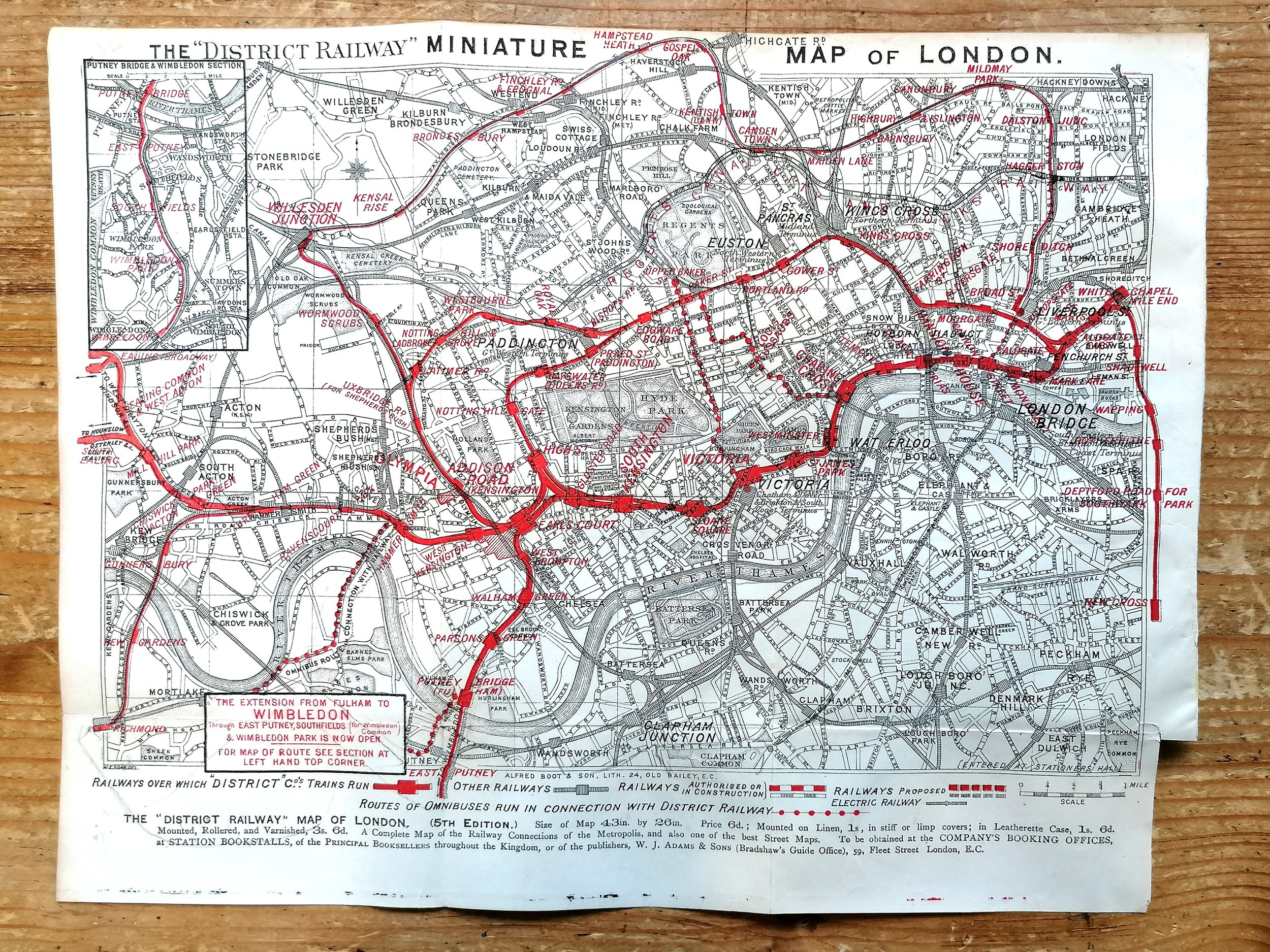
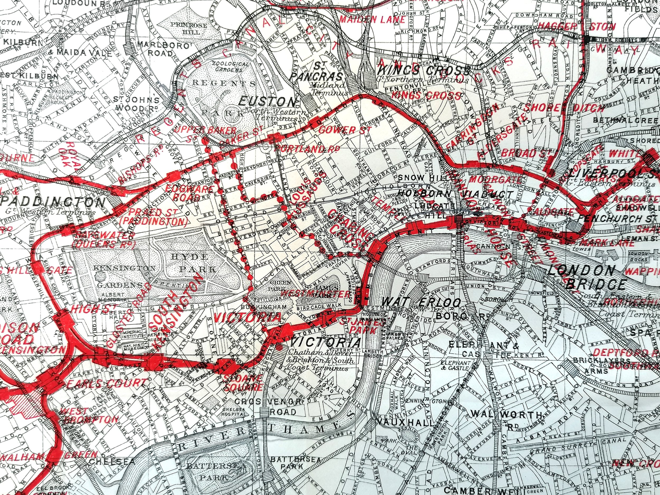
 Image 1 of 2
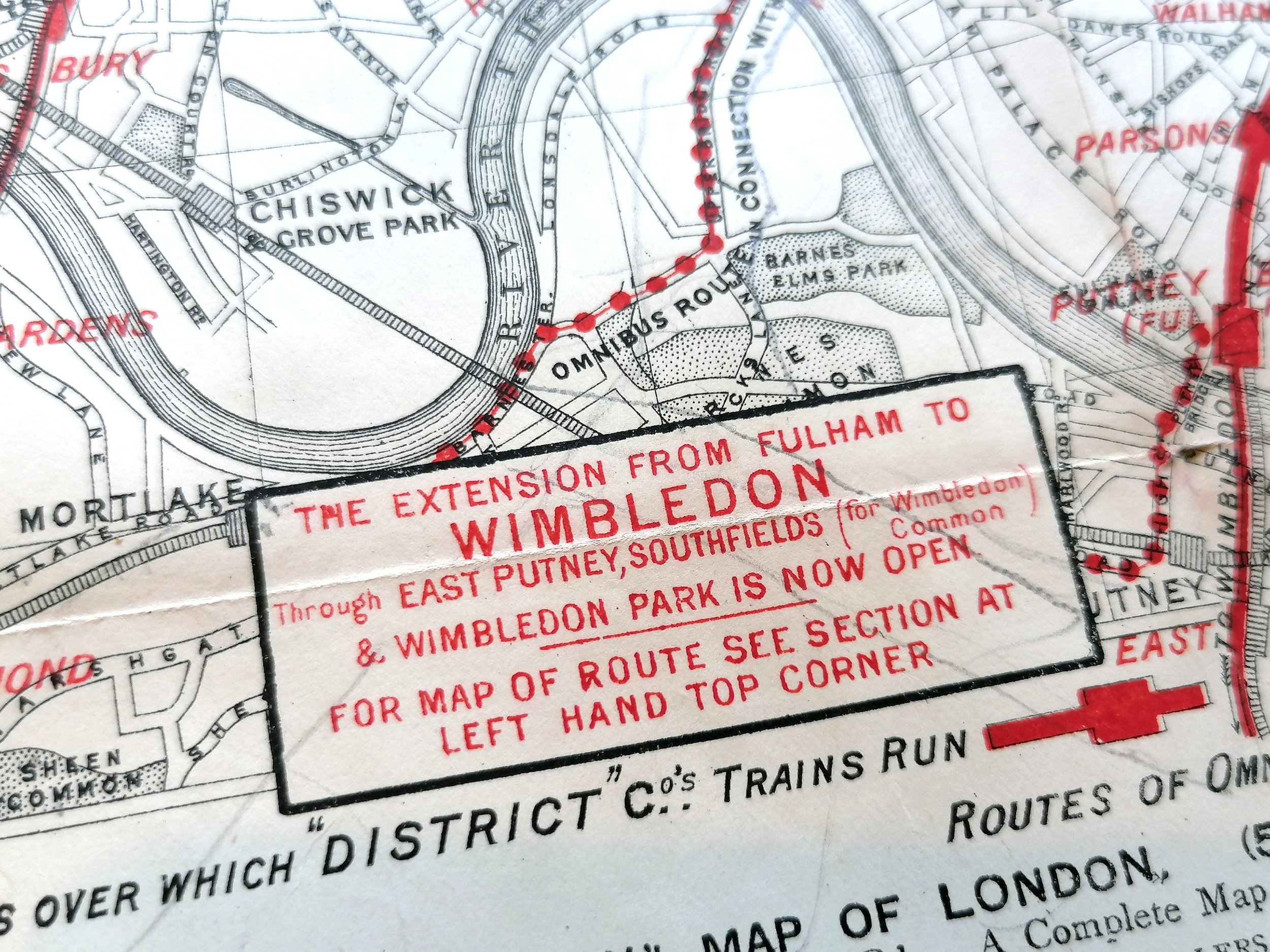
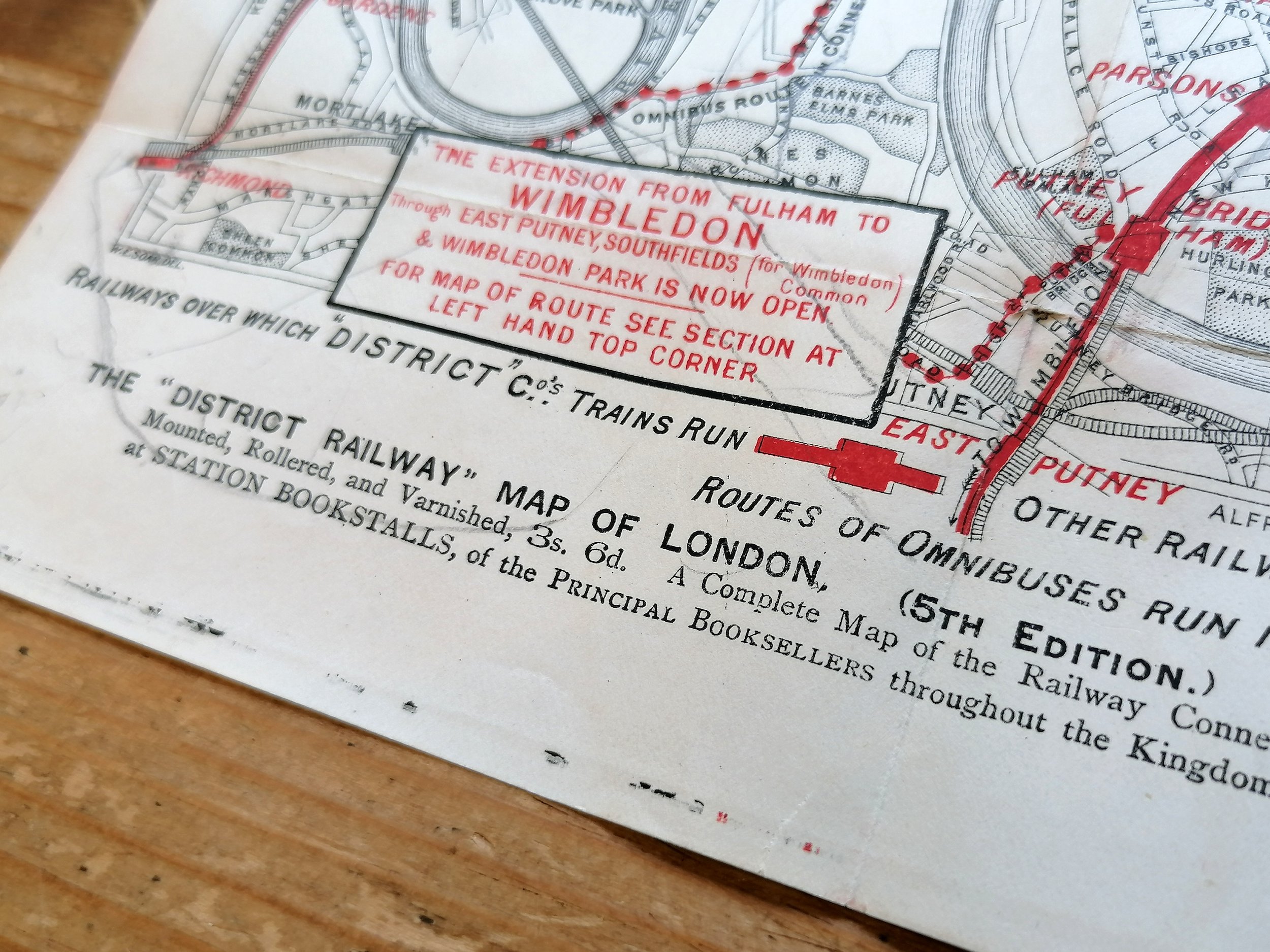
 Image 2 of 2
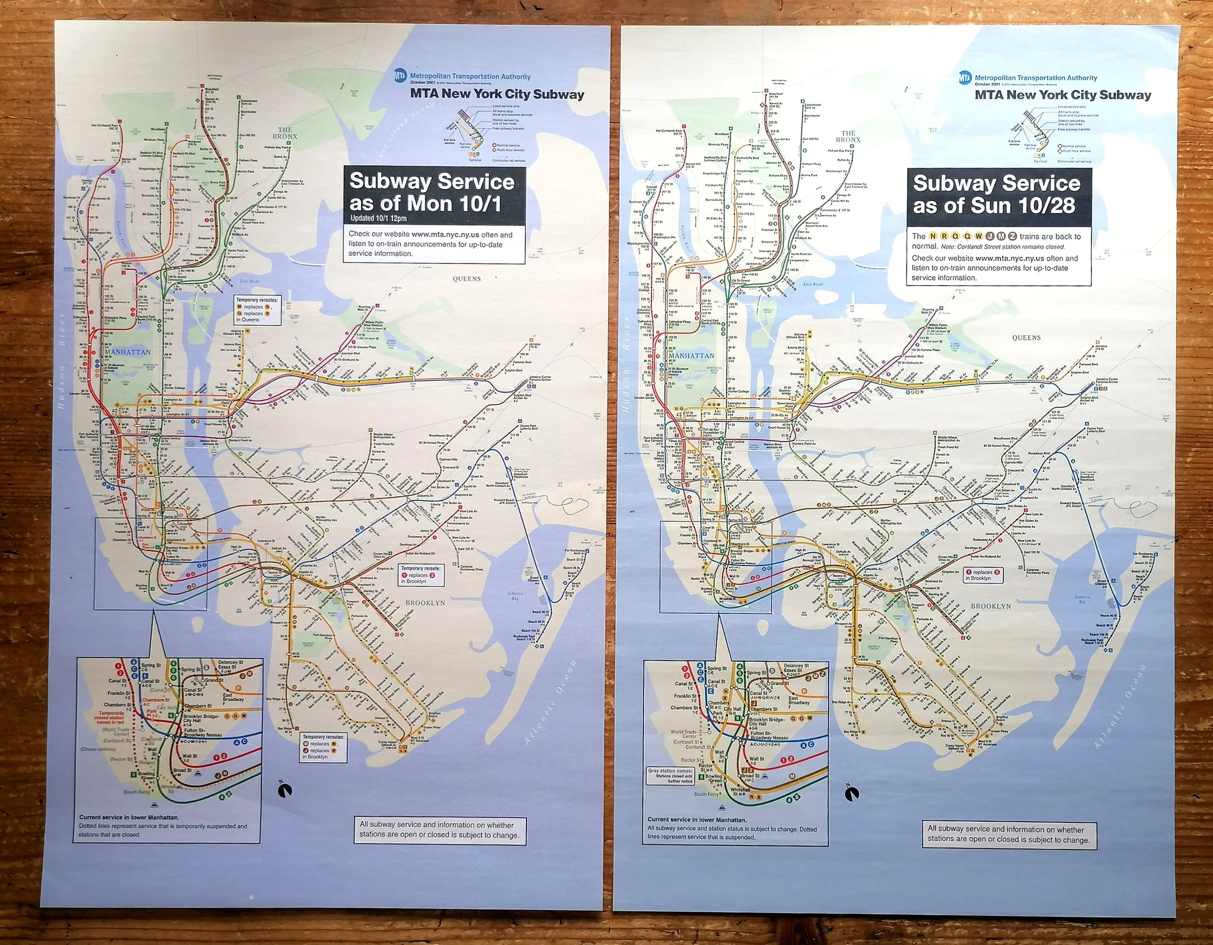
MTA New York City Subway
'Subway Service as of Mon 10/1'
'Subway Service as of Sun 10/28'
Metropolitan Transportation Authority - October 2001. Two carriage maps measuring 43.5cm x 27cm (11" x 17"). Excellent unused condition.
These two extraordinary, rare and unused 'in-carriage' maps were the first two issues following the 9/11 attacks on the World Trade Centre. They show the closed lines and stations around Ground Zero. These small format poster maps are produced for display in subway carriages.
Original maps issued immediately following the 9/11 attacks are extremely rare. No large format posters or pocket maps were issued during this time.
Free UK delivery. For non-UK delivery please request quotation