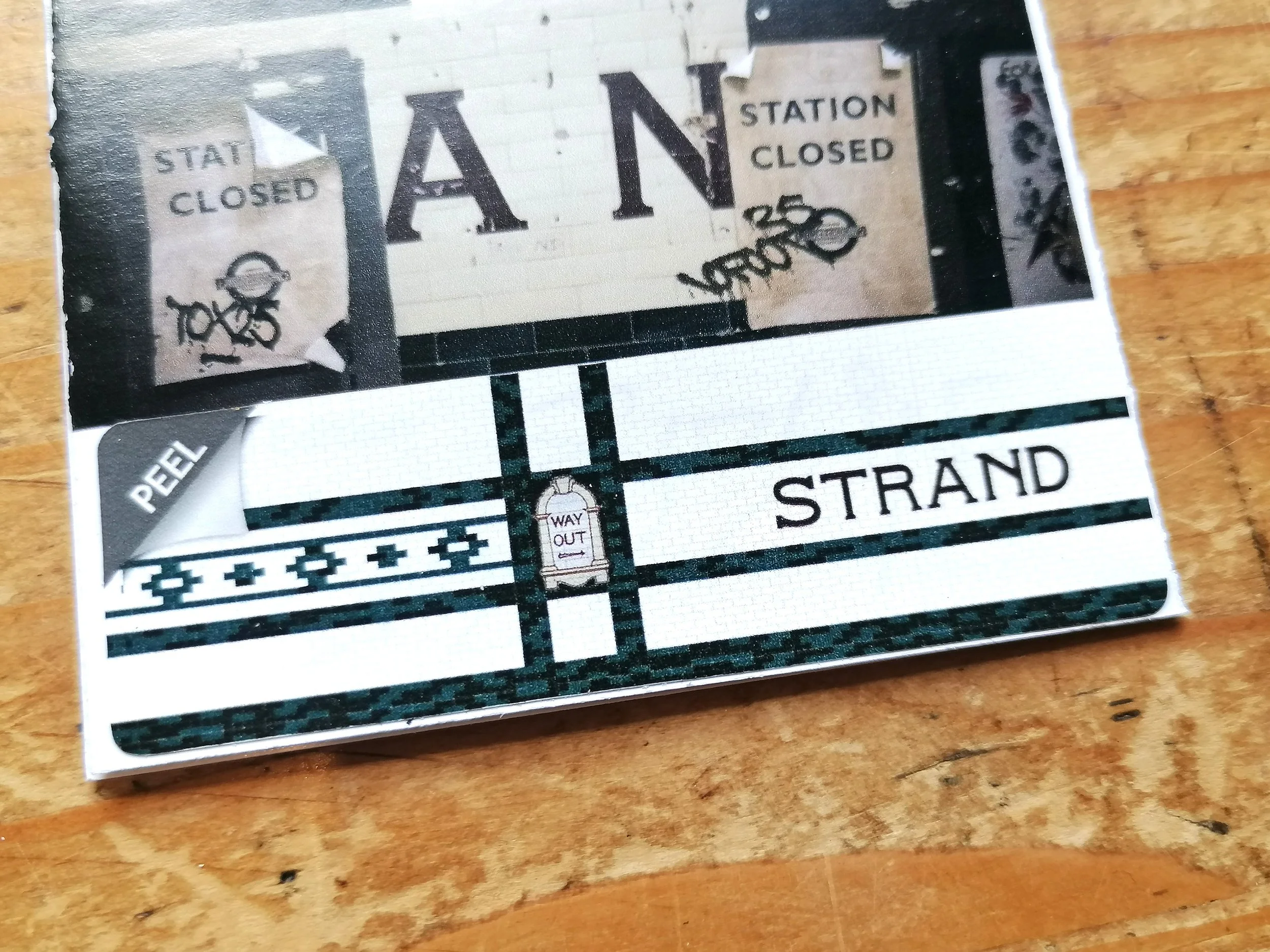
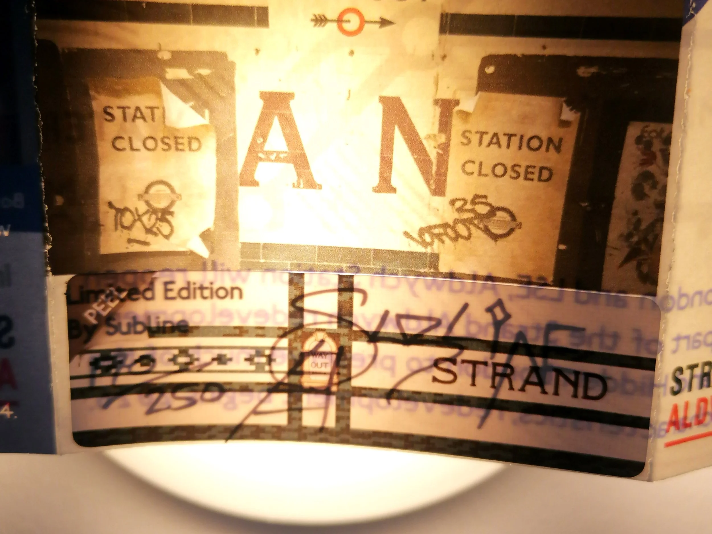
Central London Railway “London Electric Railways”
Printed by Johnson & Riddle for Central London Railway. Circa 1909. Colour lithograph on paper. Folded as issued. Measures 27cm x 22.5cm (open). A good example with some wear throughout. Some weak folds and tears have been professionally reinforced.
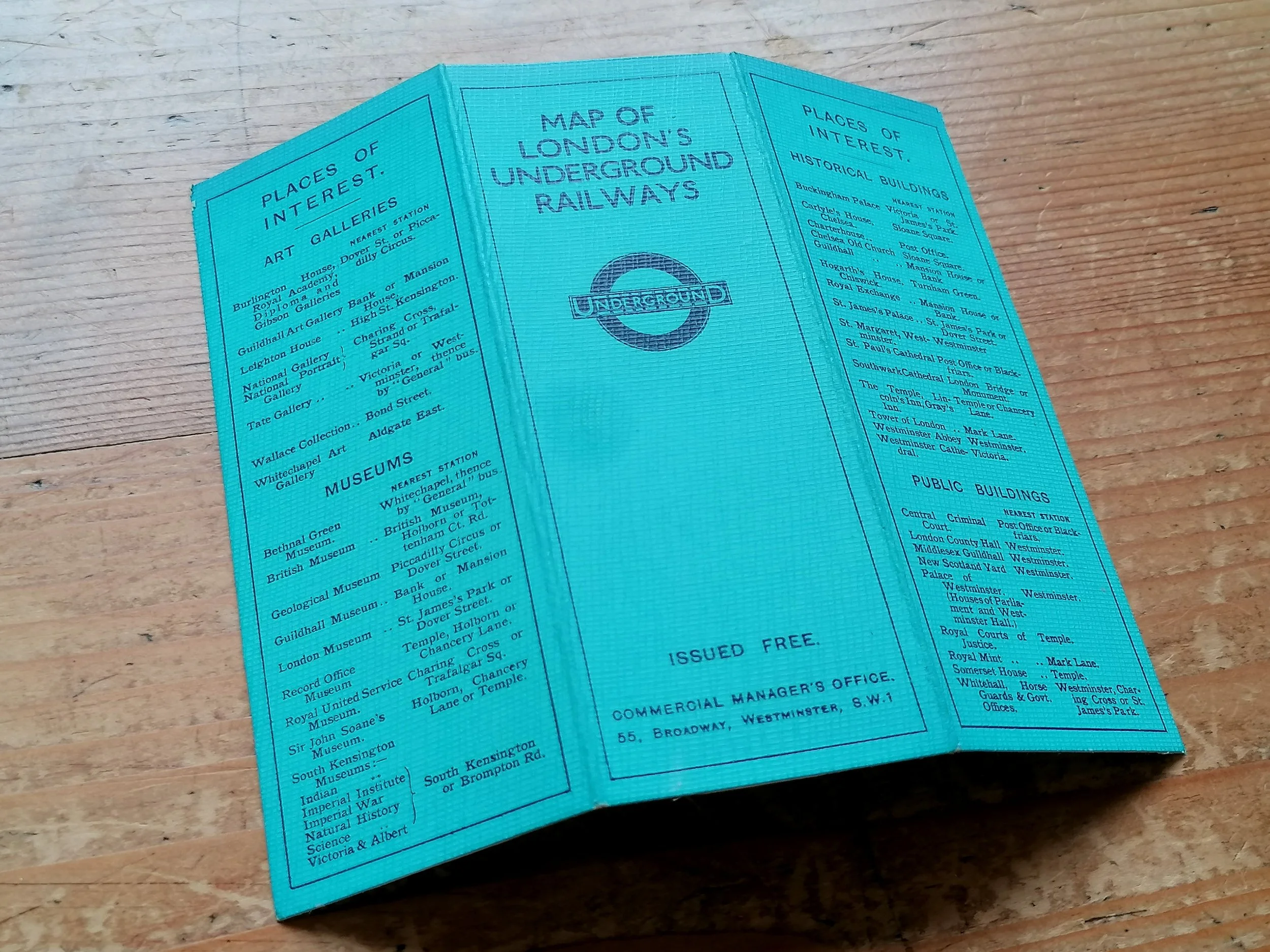
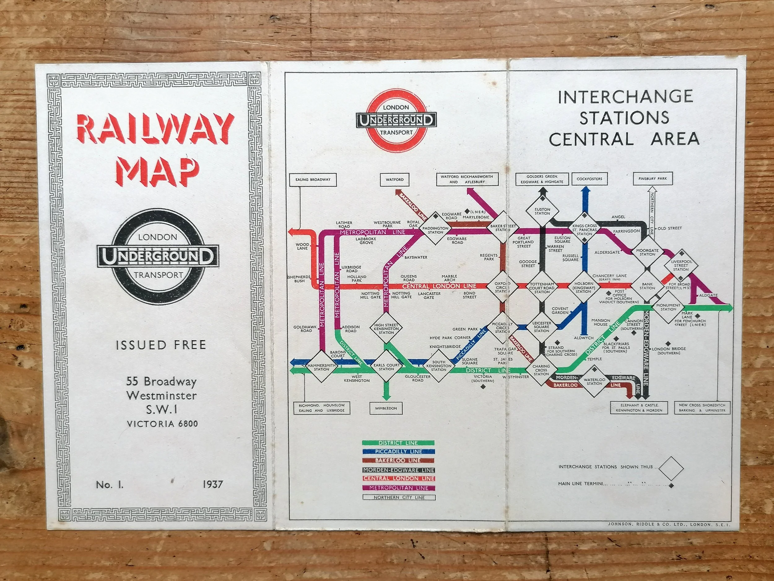
A beautiful Edwardian London Underground map, this one issued by the Central London Railway. Early unified map with additional map of the Central London Railway on the reverse side, Very rare issue with Green and red cover. This issue features in the LT Museum archives (ref 1999/2673).
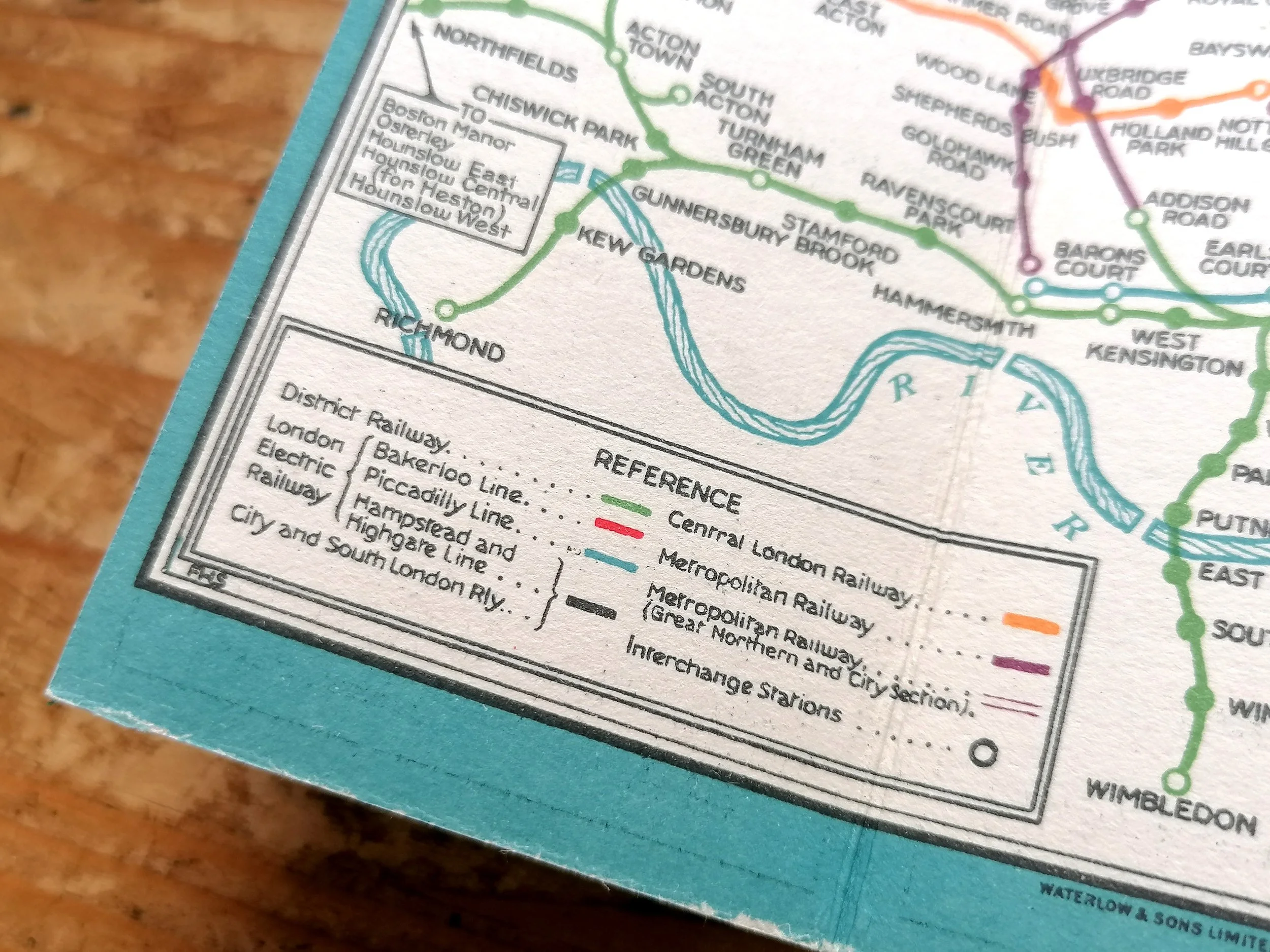
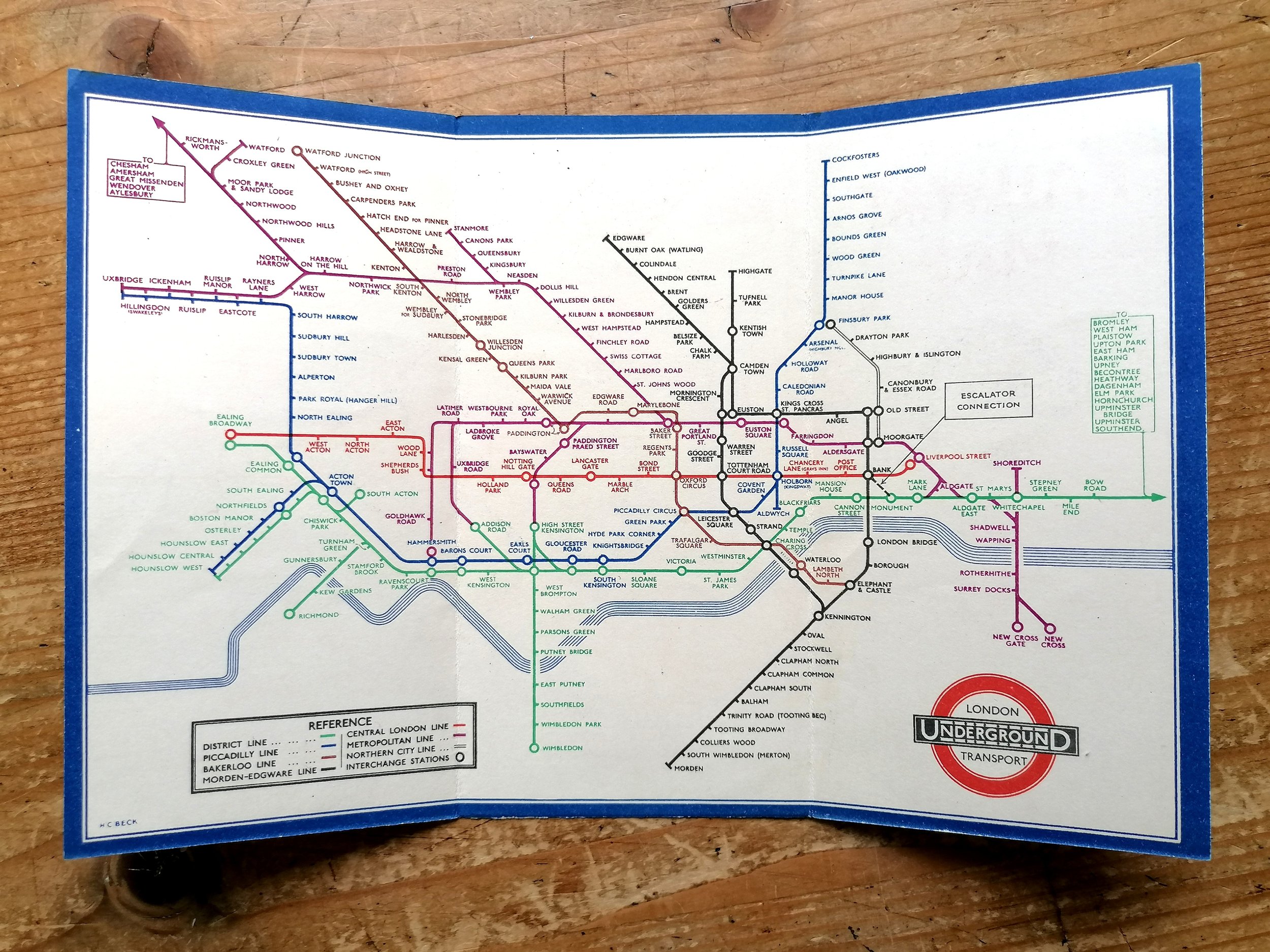
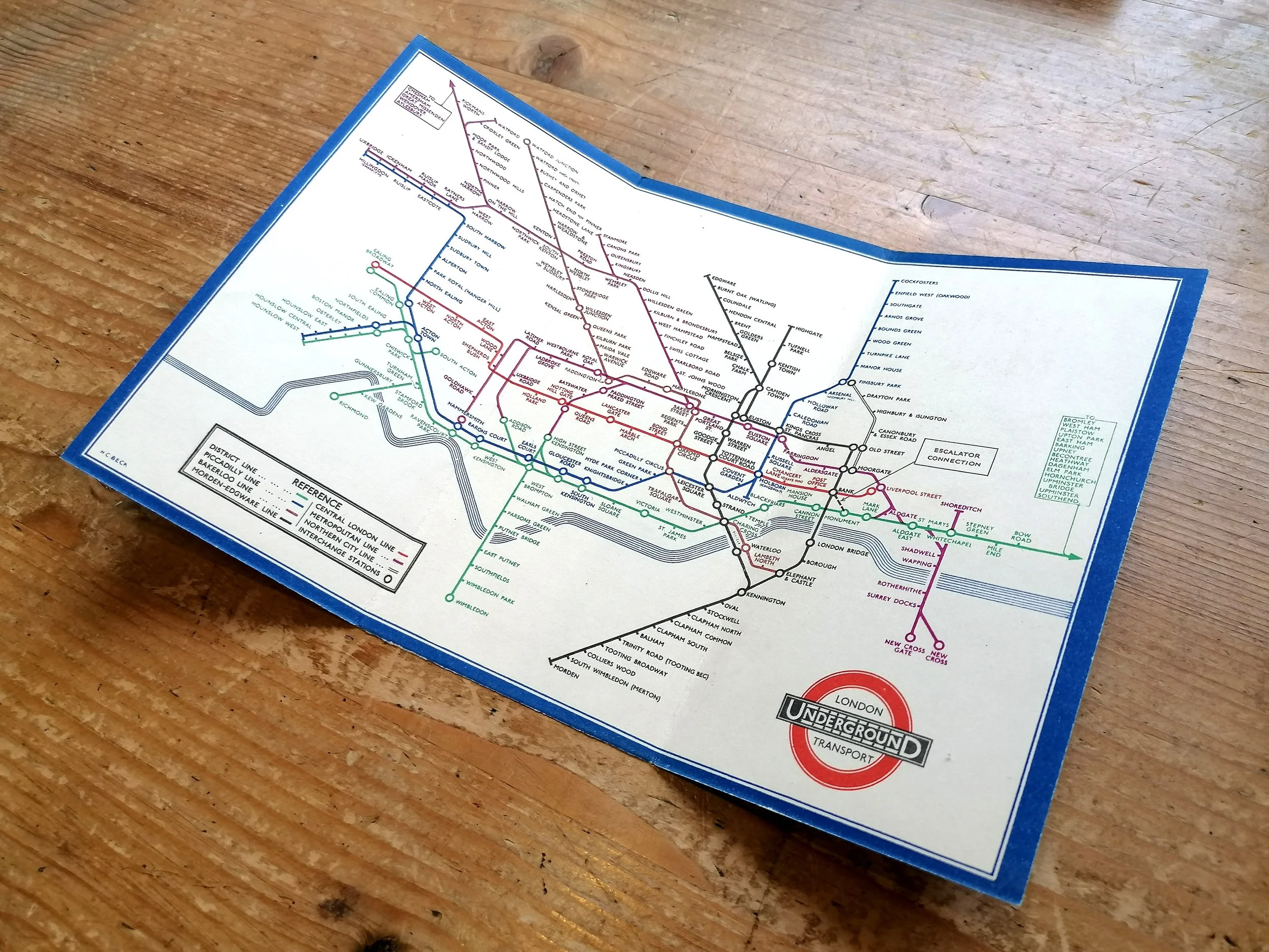
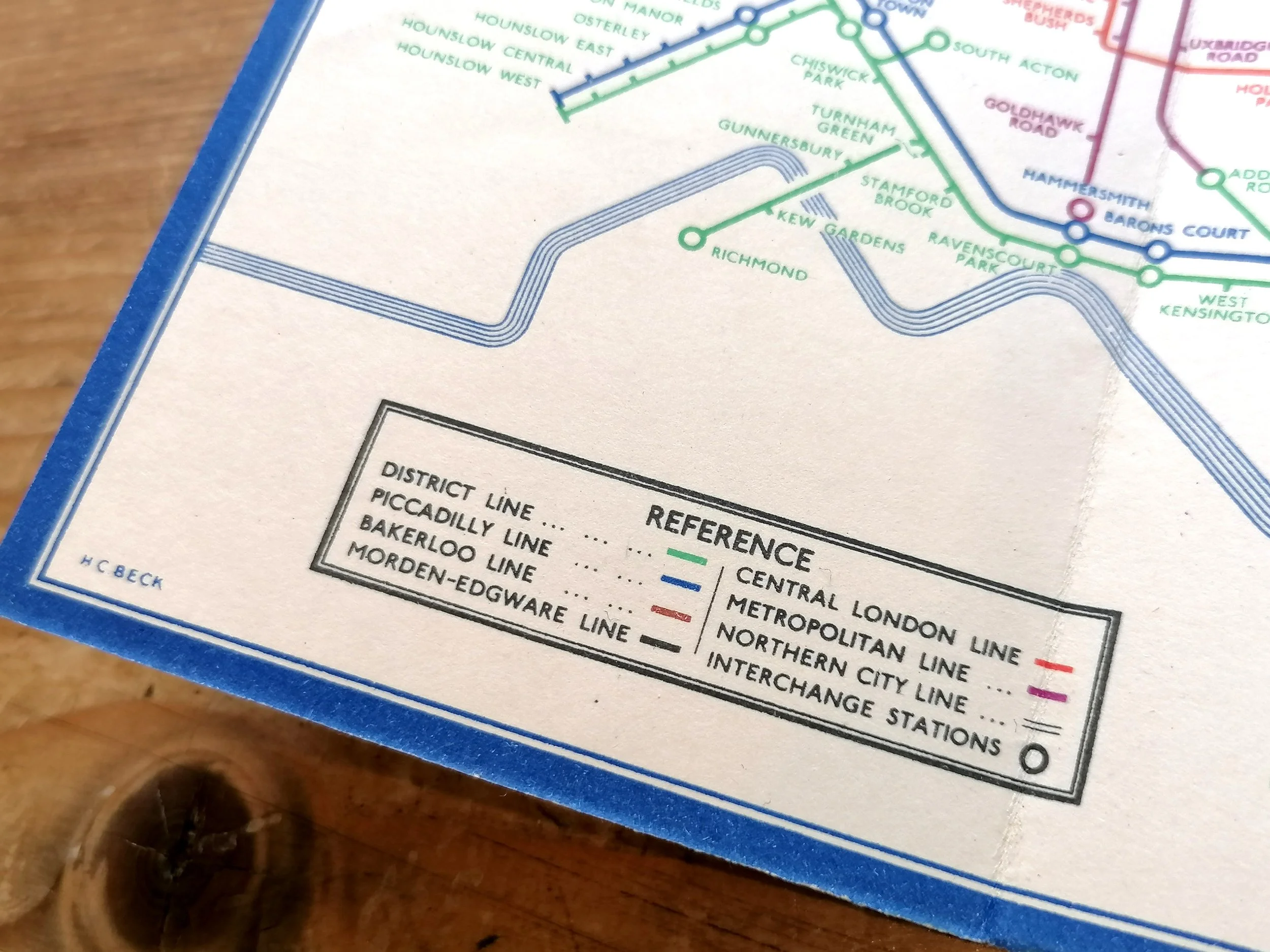
In 1908, London’s various Underground railway companies had agreed to cooperate under a unified marketing strategy that saw a single map of the network and branding, the “UndergrounD”. Yet some of the companies wishing to promoting their own interests, continued to issue their own versions of the unified map long into the 20th century. This map is such an example, issued by the Central London Railway (now Central Line).
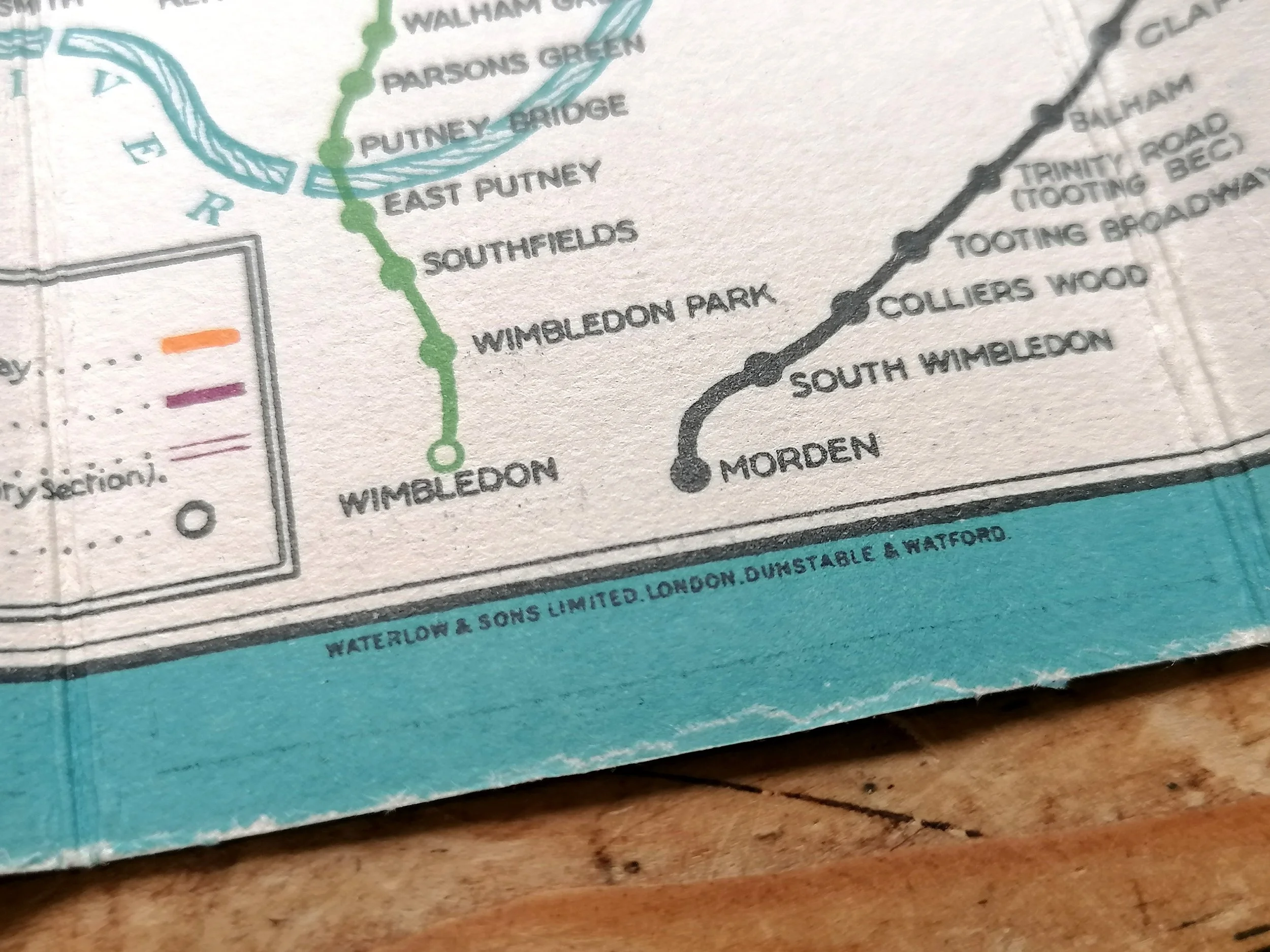
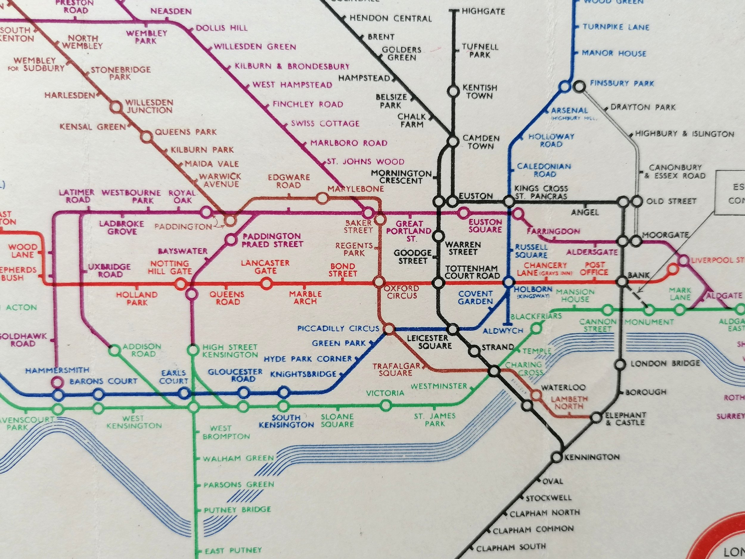
This issue dates to mid-1909. Unlike the ‘common’ map issued by the at the same time, this map doesn't carry the UndergrounD header, but instead "London Electric Railways", a carry-over from the first unified maps prior to rebranding. To date this map we look to the station names which were being changed regularly during this period. This map shows Warren Street (was Euston Road until late 1908) meanwhile Gower Street has not yet changed to Euston Square (mid 1909)
Free UK Delivery. For Non-UK delivery please request quotation.
Central London Railway “London Electric Railways”
Printed by Johnson & Riddle for Central London Railway. Circa 1909. Colour lithograph on paper. Folded as issued. Measures 27cm x 22.5cm (open). A good example with some wear throughout. Some weak folds and tears have been professionally reinforced.
A beautiful Edwardian London Underground map, this one issued by the Central London Railway. Early unified map with additional map of the Central London Railway on the reverse side, Very rare issue with Green and red cover. This issue features in the LT Museum archives (ref 1999/2673).
In 1908, London’s various Underground railway companies had agreed to cooperate under a unified marketing strategy that saw a single map of the network and branding, the “UndergrounD”. Yet some of the companies wishing to promoting their own interests, continued to issue their own versions of the unified map long into the 20th century. This map is such an example, issued by the Central London Railway (now Central Line).
This issue dates to mid-1909. Unlike the ‘common’ map issued by the at the same time, this map doesn't carry the UndergrounD header, but instead "London Electric Railways", a carry-over from the first unified maps prior to rebranding. To date this map we look to the station names which were being changed regularly during this period. This map shows Warren Street (was Euston Road until late 1908) meanwhile Gower Street has not yet changed to Euston Square (mid 1909)
Free UK Delivery. For Non-UK delivery please request quotation.

 Image 1 of 10
 Image 2 of 10
 Image 3 of 10
 Image 4 of 10
 Image 5 of 10
 Image 6 of 10
 Image 7 of 10
 Image 8 of 10
 Image 10 of 10