The District Railway Map of London - Third Edition
Designed by WE Soar. Printed by WJ Adams & Sons. Published by the Partington Advertising Company for the Metropolitan District Railway Company. Measures 107cm x 65cm. Laid on linen as issued with thin linen covers. Condition: Overall an excellent example. Covers a bit worn at edges. Please inspect the photos carefully.
Following the opening of the Metropolitan Railway (MR) in 1863, The Metropolitan District Railway (MDR) was the 2nd Underground railway to open in London in 1868, running from South Kensington to Westminster. Shortening its name to just 'District Railway', the company produced large scale maps laid on Linen between 1874 -1907, along with smaller paper pocket maps from 1877 - making these among the first maps of the London Underground.
Whilst this map is dated 1884 on the cover, it features an overprint for the Indian & Colonial Exhibition which took place in 1886 in South Kensington. It may have been overprinted after production - or more likely it is a reissue of the 1884 map printed in 1886 and the lithographers simply didn’t change the date on the cover.
The 1884 issue was the first edition to show the Inner Circle Completion Line as open - there is a nice scrolled notice announcing its opening. The line to Putney (which would be renamed East Putney) is shown in construction and would open in 1889.
Free UK delivery. For non-UK delivery please request quotation.

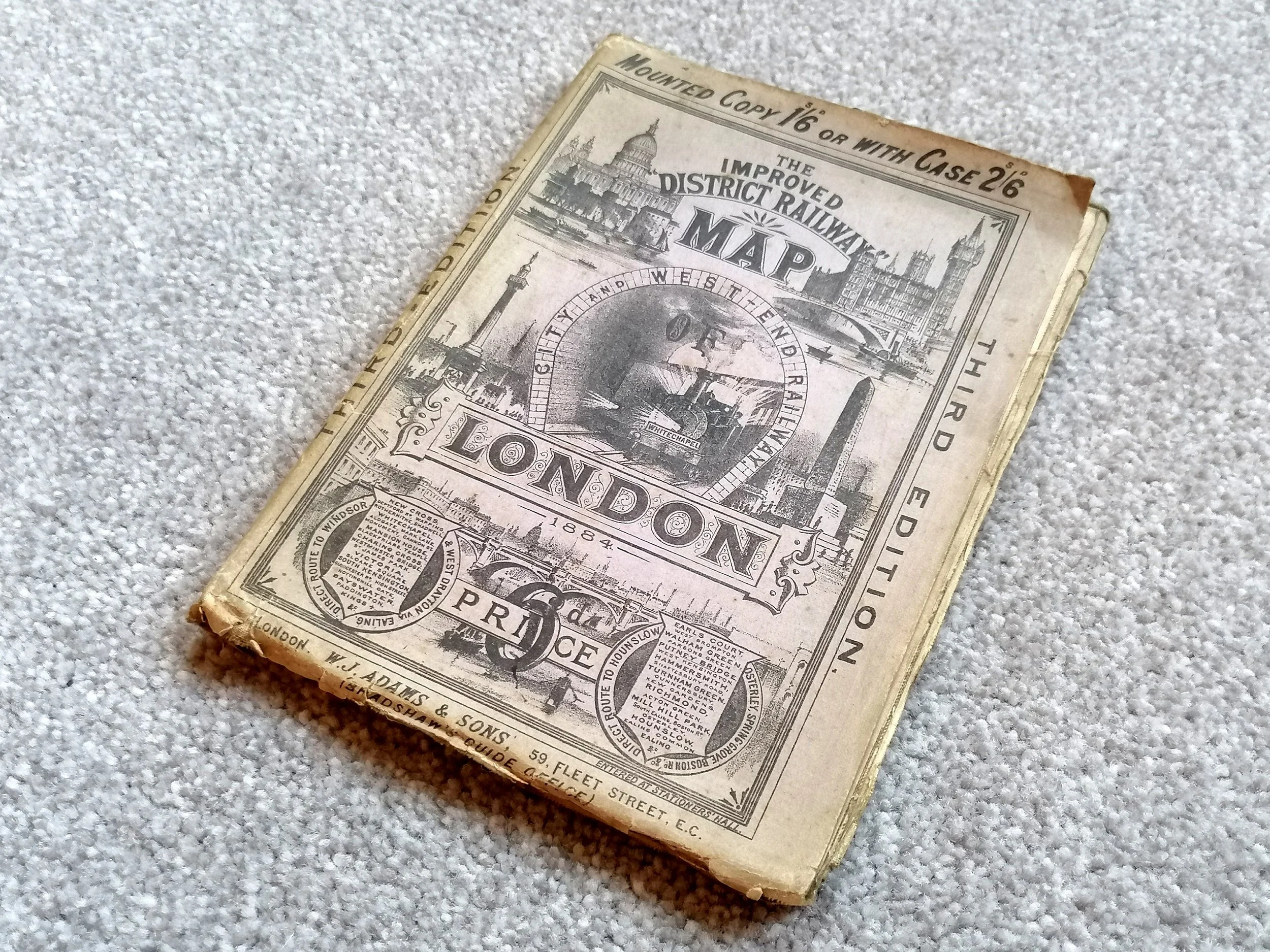 Image 1 of 14
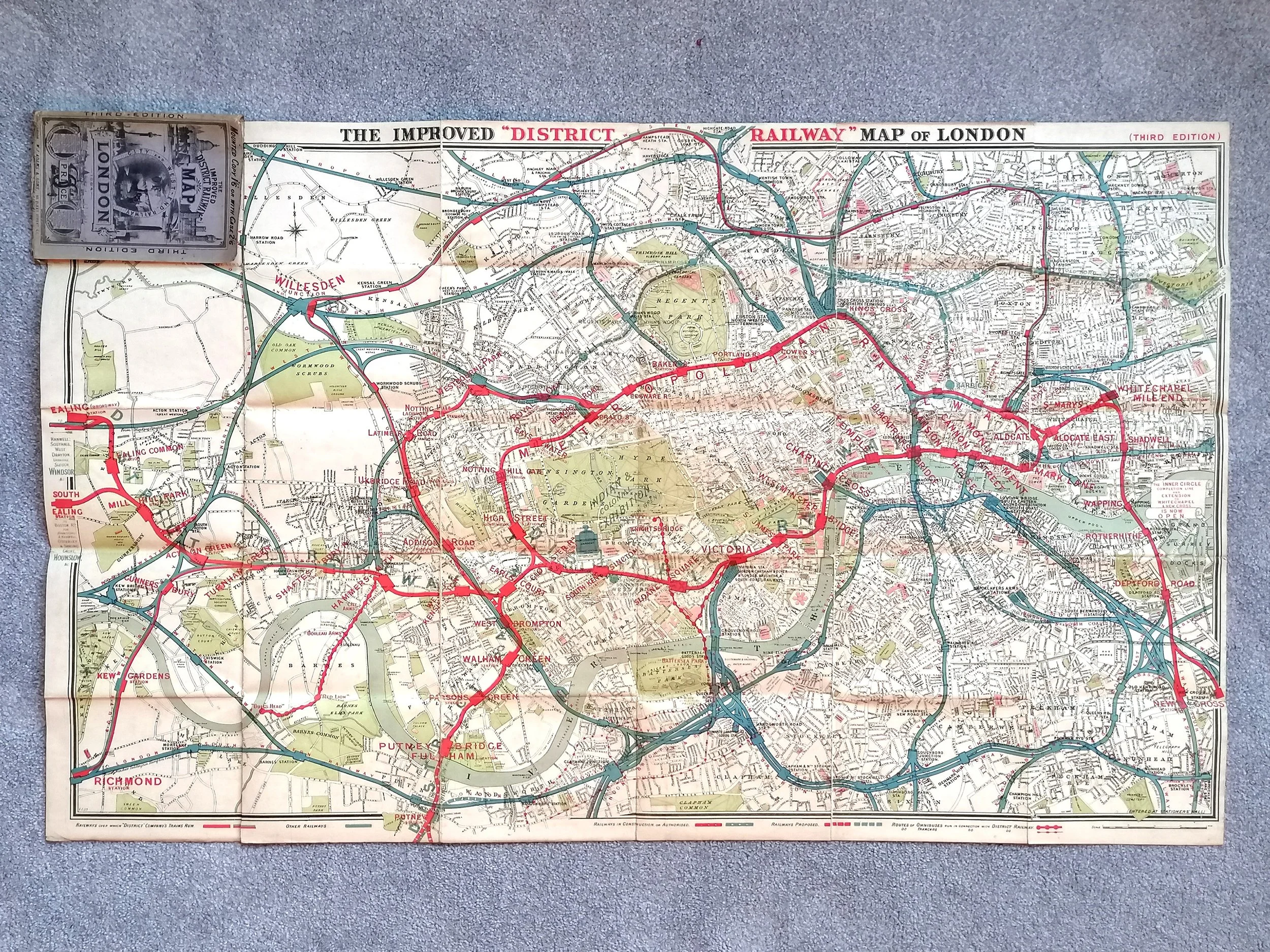 Image 2 of 14
 Image 3 of 14
 Image 4 of 14
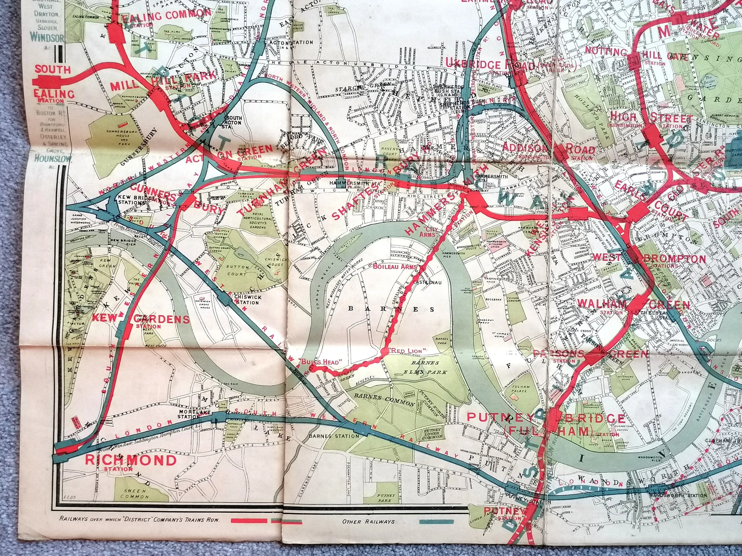 Image 5 of 14
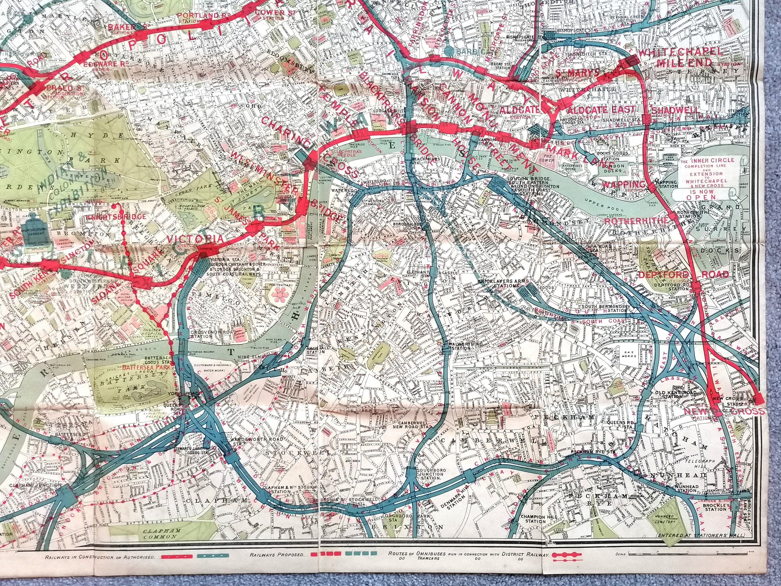 Image 6 of 14
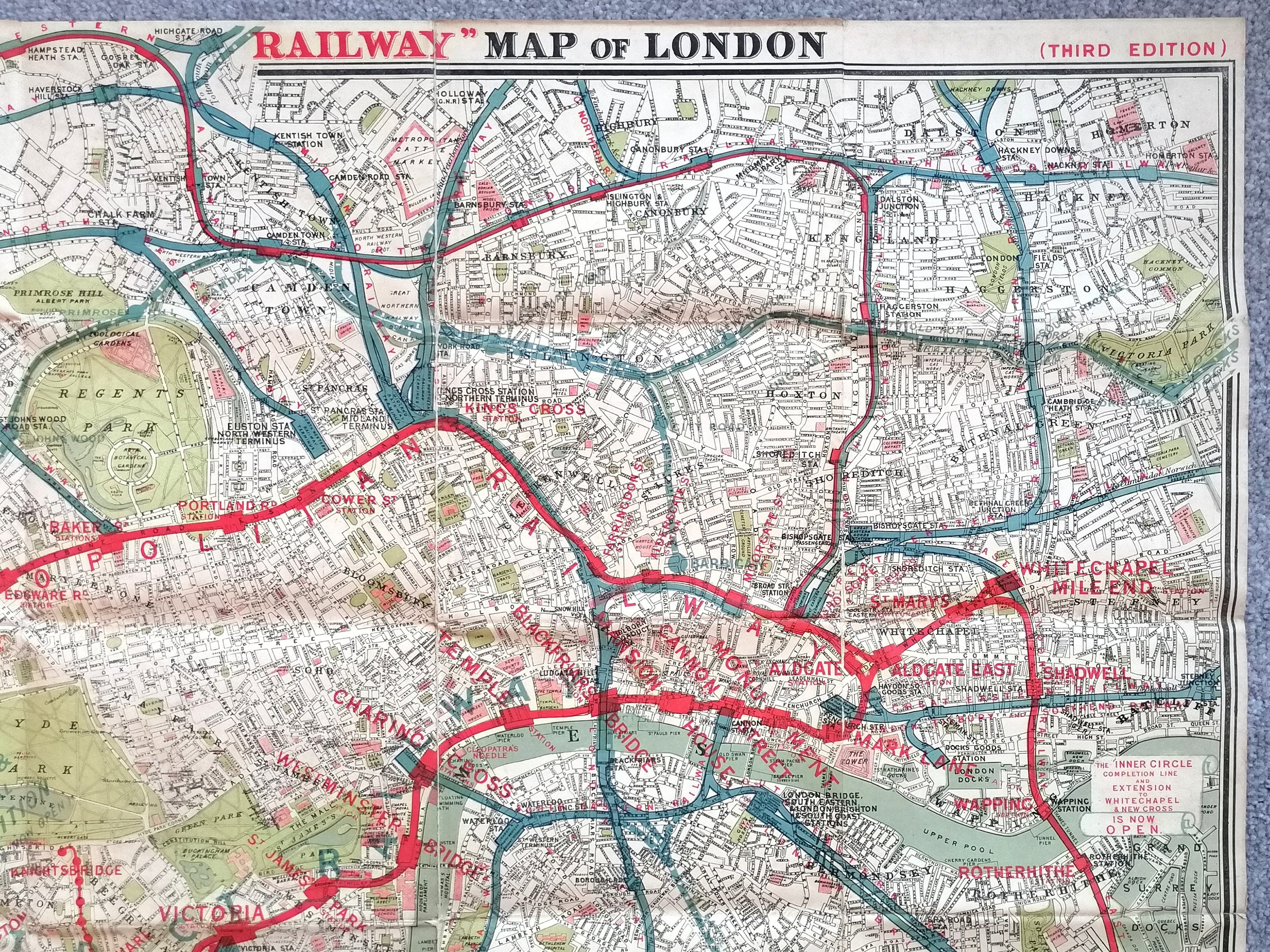 Image 7 of 14
 Image 8 of 14
 Image 9 of 14
 Image 10 of 14
 Image 11 of 14
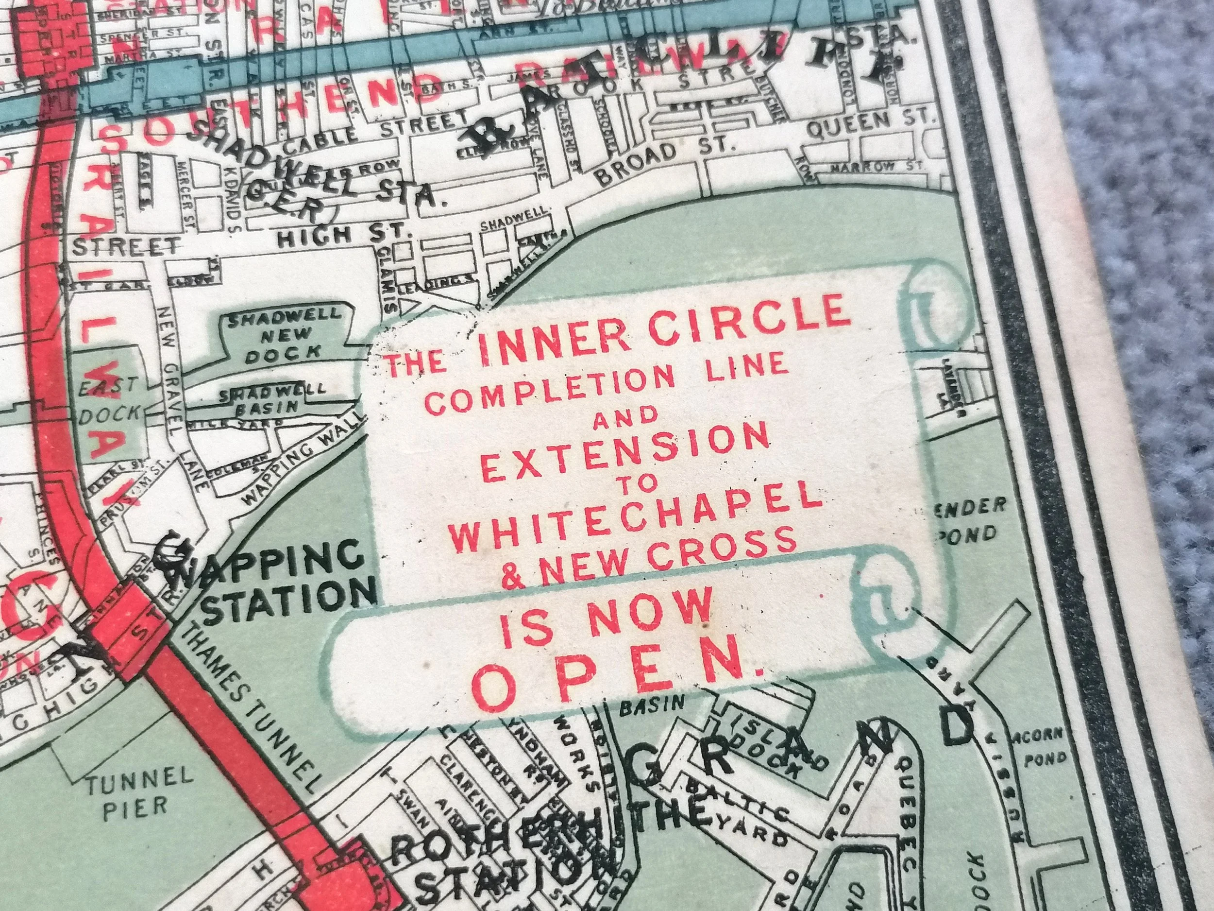 Image 12 of 14
 Image 13 of 14
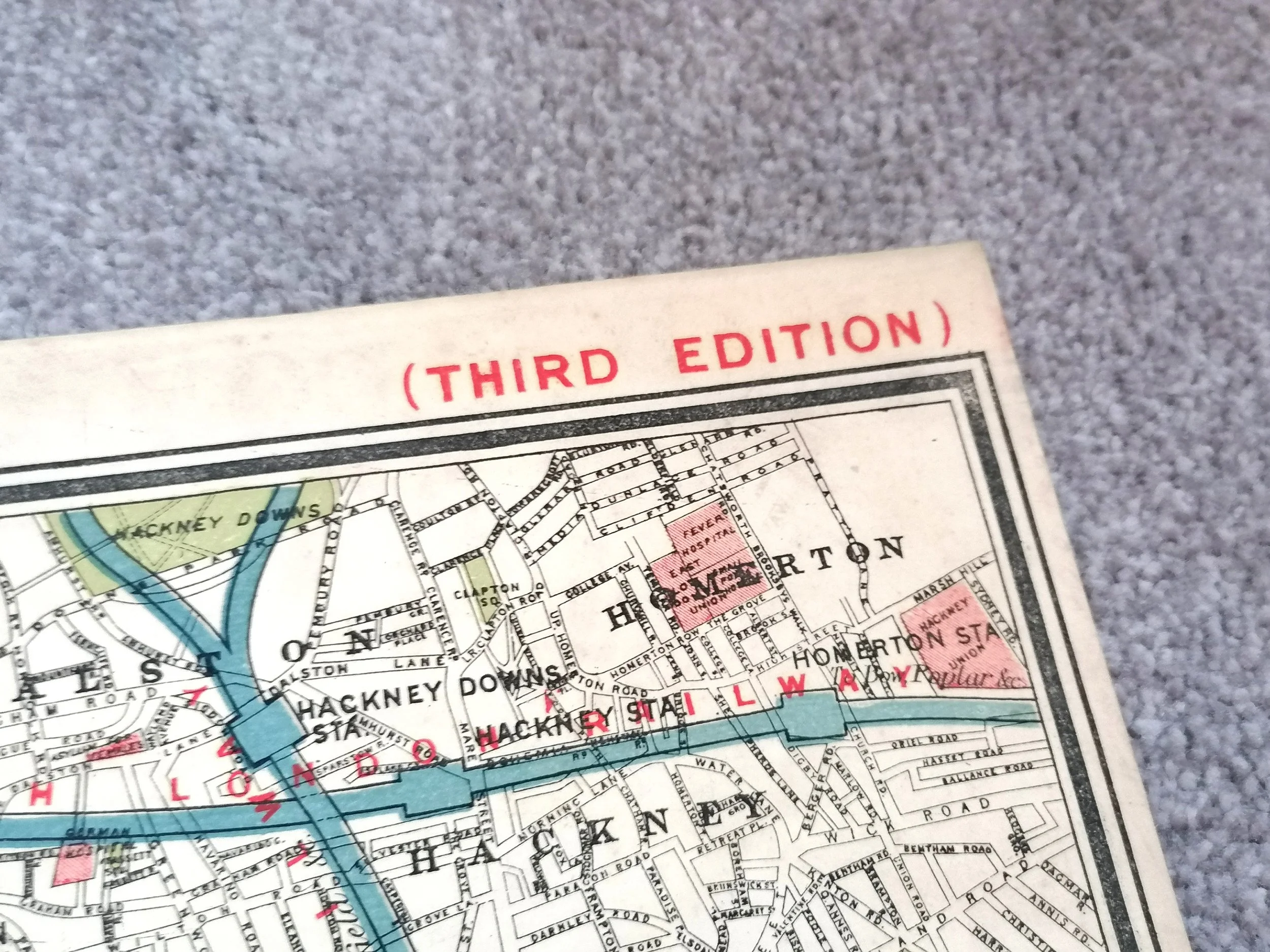 Image 14 of 14